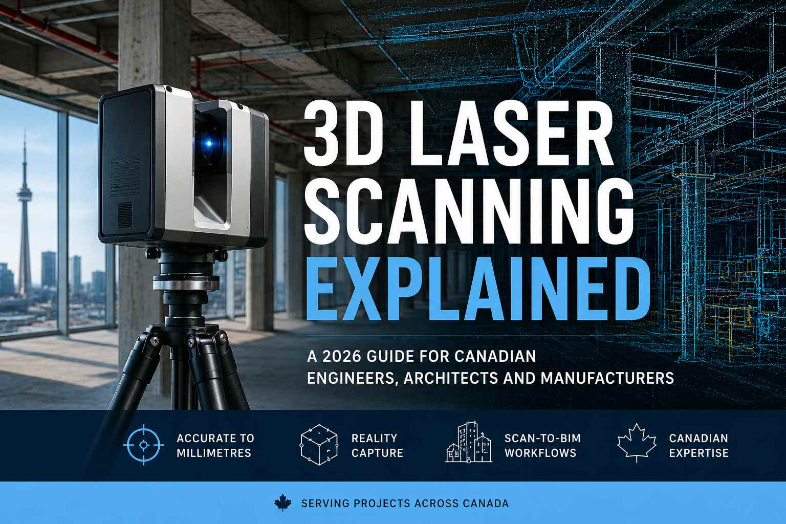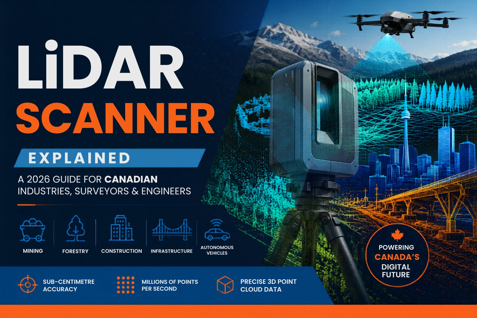
LiDAR Scanner Explained: A 2026 Guide for Canadian Industries, Surveyors and Engineers
Published: May 12, 2026 · Updated: May 12, 2026 · Reading time: ~13 min
If you've worked on a Canadian construction site, surveyed a mining operation, mapped a forest canopy, or planned the retrofit of a heritage building in downtown Toronto — there's a good chance a LiDAR scanner was involved somewhere in the project. From the Ring of Fire mineral exploration in Northern Ontario to autonomous vehicle development in the Greater Toronto Area, LiDAR technology has quietly become one of the most important tools in Canadian industry.
This guide is written for engineers, surveyors, construction managers, mining operators, forestry professionals, and project leaders across Canada who are evaluating LiDAR scanners and LiDAR scanning services in 2026. By the time you finish, you'll understand how LiDAR works, the different types of scanners available, which industries rely on them most, how much they cost, and how to choose the right scanning service for your project.
A LiDAR scanner is a remote sensing device that uses pulsed laser light to measure distances between the sensor and surrounding objects, then converts those measurements into highly accurate 3D point cloud data. Modern LiDAR scanners can transmit up to 2 million laser pulses per second and capture sub-centimetre accuracy at distances ranging from a few metres to several kilometres. In Canada, LiDAR scanners are used across mining, forestry, construction, autonomous vehicles, civil engineering, BIM modelling, and infrastructure surveying. Professional LiDAR scanning services range from $1,500 for a small commercial building to $25,000+ for large-scale aerial surveys.
What this guide covers
- What is a LiDAR scanner?
- How does a LiDAR scanner work?
- The 4 main types of LiDAR scanners
- LiDAR accuracy and specifications
- Why LiDAR adoption is surging in Canada
- Canadian industries using LiDAR scanners
- How much does LiDAR scanning cost?
- LiDAR vs photogrammetry: which to choose
- The LiDAR scanning workflow step by step
- How to choose a LiDAR scanning provider
- Future of LiDAR in Canada
- Frequently asked questions
What is a LiDAR scanner?
A LiDAR scanner — short for Light Detection and Ranging — is a sensor that fires laser pulses at surrounding surfaces and measures how long each pulse takes to return. By doing this hundreds of thousands of times per second, the scanner builds a precise three-dimensional map of everything around it. The output is a point cloud: millions of measured points in 3D space that together form an exact digital replica of the scanned environment.
LiDAR is fundamentally different from photography. A camera captures colour and light; a LiDAR scanner captures geometry. Where a photograph shows you what something looks like, a LiDAR scan shows you exactly what something is — every dimension, every angle, every surface — accurate to within millimetres.
This precision is what makes LiDAR so valuable. Canadian Natural Resources Canada notes that state-of-the-art LiDAR scanners can transmit and receive as many as 500,000 pulses of laser light per second, producing data dense enough to map forests, terrain, and infrastructure in three-dimensional detail. The technology has been quietly transforming Canadian industries for years — and 2026 marks a tipping point in how widely it's being adopted.
How does a LiDAR scanner work?
The principle is elegant. A LiDAR scanner contains three core components working together: a laser emitter, a receiver, and a precise internal clock. When the laser fires a pulse of light, the clock starts timing. When that pulse reflects off a surface and returns to the receiver, the clock stops. By multiplying that travel time by the speed of light and dividing by two, the scanner calculates the exact distance to the point where the pulse hit.
This calculation happens millions of times per second. The scanner is either rotating (for terrestrial LiDAR), moving along a vehicle path (for mobile LiDAR), or flying above the ground (for airborne LiDAR) — and every laser pulse adds another measured point to the growing 3D model.
Modern LiDAR scanners also capture additional information beyond distance. They record the intensity of each returned pulse (how reflective the surface was), the angle at which the pulse was emitted, and often the RGB colour from a built-in camera. The result is a richly detailed point cloud that not only shows the shape of objects but also distinguishes materials, surfaces, and features.
All three technologies measure distance using a wave-based pulse, but they use different waveforms. LiDAR uses light (laser), radar uses radio waves, and sonar uses sound. LiDAR offers vastly higher resolution than radar — which is why autonomous vehicles use LiDAR for fine-grained obstacle detection while radar handles longer-range tracking.
The 4 main types of LiDAR scanners
Not all LiDAR scanners do the same job. The right scanner depends on what you're measuring, how big the area is, what accuracy you need, and whether the environment is accessible by foot, vehicle, or aircraft. Here are the four primary categories you'll encounter in Canadian projects.
1. Terrestrial (Static) LiDAR Scanner
Tripod-mounted scanners that capture extremely high-precision data from a fixed position. The scanner rotates 360° while collecting data, then moves to the next setup point. Used heavily for 3D laser scanning of buildings, factories, heritage sites, and complex industrial environments.
2. Mobile LiDAR Scanner
Vehicle-mounted scanners that capture data while moving. Common for road and highway surveying, urban mapping, utility corridor inspection, and infrastructure assessment. Mobile LiDAR is critical for Canadian municipal road maintenance programs and Metrolinx-style transit infrastructure projects.
3. Aerial (Airborne) LiDAR Scanner
Mounted on drones (UAV) or manned aircraft for large-area capture. Drone LiDAR delivers centimetre-level accuracy over hundreds of acres in a single flight. Manned-aircraft LiDAR covers vast regions — entire mining operations, watersheds, or forestry blocks. The aerial category dominated 2025 with 47% market share, according to Precedence Research.
4. Handheld SLAM LiDAR Scanner
Portable, walk-through scanners that use Simultaneous Localization and Mapping (SLAM) to track their own position while scanning. Designed for indoor spaces, underground tunnels, confined areas, and any environment where GPS doesn't work. Mining operators across Northern Ontario use SLAM scanners to map underground drifts safely.
LiDAR accuracy and specifications
Accuracy is the single most important specification when selecting a LiDAR scanner for your project. The wrong accuracy class will either deliver useless data or waste budget on precision you don't need. Here's how Canadian professionals match accuracy to application:
| Application | Required Accuracy | Suitable LiDAR Type |
|---|---|---|
| Heritage building documentation | ± 1–3 mm | Terrestrial / Static |
| BIM modelling (LOD 300+) | ± 3–6 mm | Terrestrial / Static |
| Industrial as-built CAD | ± 2–5 mm | Terrestrial / Static |
| Mining stockpile volumetrics | ± 2–5 cm | Aerial (Drone) |
| Highway and road surveying | ± 1–3 cm | Mobile LiDAR |
| Forest canopy / biomass | ± 10–30 cm | Aerial (Aircraft) |
| Watershed / floodplain mapping | ± 15–30 cm | Aerial (Aircraft) |
| Autonomous vehicle navigation | ± 2–5 cm real-time | Vehicle-mounted |
Beyond accuracy, three other specifications matter in real-world deployments: range (how far the scanner can reliably measure), point density (how many points per square metre — higher density means more detail), and scan rate (points per second — higher rate means faster fieldwork). Professional Canadian providers will discuss all four parameters before quoting your project.
Why LiDAR adoption is surging in Canada in 2026
Canada is one of the world's most active LiDAR markets — driven by a unique combination of factors that don't exist in every country.
North American LiDAR market, 2025
Projected CAGR through 2030
North America's share of global market
Aerial LiDAR segment share, 2025
According to Fortune Business Insights, the North American LiDAR market was valued at USD $1.04 billion in 2025 and is projected to reach $1.23 billion in 2026. MarketsAndMarkets forecasts even more aggressive growth — projecting the North American market to hit USD $4.80 billion by 2030 at a CAGR of 30.9%. Three Canada-specific drivers explain this acceleration.
1. Resource extraction at a national scale
Canada's mining, oil sands, and forestry sectors operate at a scale few other countries match. Northern Ontario's mining basin around Sudbury, Timmins, and Thunder Bay — along with the Ring of Fire exploration zone — relies heavily on aerial LiDAR for terrain modelling, stockpile measurement, and exploration mapping. Natural Resources Canada has been a national leader in deploying aerial LiDAR for forest inventory, with active projects across Ontario, Quebec, Alberta, and Newfoundland.
2. Aging infrastructure requiring digital twins
Cities across Canada — Toronto, Ottawa, Montreal, Calgary — are renovating, retrofitting, and replacing decades-old infrastructure. From the Ontario Line transit expansion in Toronto to heritage building restoration projects in old Montreal, LiDAR scanners provide the as-built documentation that modern engineering requires. Once a structure is scanned, it becomes a permanent digital asset for future maintenance and modification.
3. Cost reduction and technology maturity
Five years ago, a survey-grade LiDAR scanner cost upwards of $200,000. Today, drone-mounted LiDAR systems deliver comparable results at a fraction of the cost, and professional LiDAR scanning services have become accessible to mid-size businesses that previously couldn't afford the technology. Solid-state LiDAR — the type expected to dominate automotive applications — is driving costs down further.
Canadian industries using LiDAR scanners
LiDAR isn't a niche technology in Canada. It's embedded in routine operations across many of the country's largest industries.
⛏️ Mining & Mineral Exploration
Stockpile volumetrics, pit surveying, underground drift mapping, and exploration. Critical for Northern Ontario operations in Sudbury, Timmins, and the Ring of Fire mining zone.
🌲 Forestry & Land Management
Canopy height mapping, biomass estimation, forest inventory, and wildfire risk assessment. Used widely by Natural Resources Canada and provincial forestry departments.
🏗️ Construction & AEC
As-built scanning, BIM modelling, construction progress monitoring, and clash detection. Standard practice for GTA commercial development and Ontario Line transit projects.
🛣️ Civil Engineering & Roads
Highway corridor mapping, road condition assessment, bridge inspection, and pavement analysis. Municipal infrastructure assessments across Toronto, Ottawa, and Hamilton.
🚗 Automotive & Autonomous Vehicles
Real-time obstacle detection, ADAS systems, and self-driving navigation. Ontario's automotive sector — particularly in Oshawa and Windsor — is investing heavily in vehicle-mounted LiDAR.
🛢️ Oil, Gas & Energy
Pipeline corridor mapping, facility inspection, vegetation encroachment monitoring, and emergency response planning. Vital for Alberta's oil sands and Atlantic offshore operations.
🏛️ Heritage & Archaeology
Documentation of historic buildings, monuments, and archaeological sites. Used to preserve Canadian heritage assets and inform restoration projects.
🌾 Agriculture & Precision Farming
Crop health monitoring, field topography, drainage planning, and yield mapping. Growing adoption across Ontario, Manitoba, and Saskatchewan agricultural regions.
⚡ Utilities & Power Lines
Transmission line corridor mapping, vegetation management, and asset inventory. Hydro One and other Canadian utilities use airborne LiDAR routinely.
🌊 Environmental & Watershed
Floodplain mapping, coastal erosion monitoring, watershed analysis, and climate resilience planning. Conservation authorities across Ontario rely on aerial LiDAR data.
How much does LiDAR scanning cost in Canada?
LiDAR scanning costs in Canada vary widely based on project scope. Pricing is driven primarily by site size, required accuracy, type of scanner needed, travel distance, and what deliverables you need (raw point cloud, processed CAD model, BIM model, or analytical reports). Here are typical 2026 price tiers for professional LiDAR scanning services in Canada:
Small building (under 10,000 sq ft), single-floor scan, point cloud delivery. Typical for retail spaces or small offices.
Industrial facilities, multi-floor commercial, mining stockpile surveys, or aerial drone LiDAR for moderate-size sites.
Large industrial complexes, multi-acre aerial surveys, full BIM deliverables, mining-scale topographic mapping.
Equipment costs (if you're buying instead of hiring a service)
For organizations considering buying a LiDAR scanner outright:
- Entry-level handheld SLAM scanners: $20,000–$40,000
- Mid-range terrestrial scanners: $40,000–$100,000
- Survey-grade terrestrial scanners: $100,000–$200,000
- Drone LiDAR payloads: $50,000–$150,000 (plus the drone)
- Aircraft-mounted survey systems: $300,000–$700,000+
Hiring a professional LiDAR scanning service makes more financial sense than purchasing equipment outright. A typical commercial scanner costs more than 5 years of regular outsourced scanning — and that's before factoring in operator training, software licensing, maintenance, and calibration. Outsourcing also gives you access to multiple scanner types matched to each project.
LiDAR vs photogrammetry: which to choose
One of the most common questions Canadian project managers face is whether to use LiDAR or photogrammetry for a given project. Both produce 3D point clouds, but they work differently and excel in different conditions.
| Factor | LiDAR | Photogrammetry |
|---|---|---|
| How it works | Active laser pulses measure distance | Passive photos triangulated for depth |
| Vegetation penetration | ✓ Yes — captures ground under canopy | ✗ No — only top of canopy visible |
| Low light / darkness | ✓ Works in complete darkness | ✗ Requires good daylight |
| Geometric precision | ✓ Higher — direct measurement | ~ Lower — calculated from images |
| Photorealistic colour | ~ Limited (intensity-based) | ✓ Excellent RGB texture |
| Cost | Higher equipment cost | Generally lower cost |
| Best for | Engineering, forestry, mining | Visualization, marketing, mapping |
The honest answer: many Canadian projects benefit from combining both methods. A construction site progress report might use photogrammetry for visual updates and LiDAR for precise volumetric measurements. A mining operation may use aerial LiDAR for terrain and photogrammetry for stockpile visualization. A skilled provider will recommend the right combination based on your specific deliverables.
The LiDAR scanning workflow step by step
Understanding the workflow helps you plan budget and timeline accurately. Most Canadian LiDAR projects follow these five stages:
- Site assessment and planning — Provider reviews your project, identifies access constraints, selects the right scanner type, and establishes ground control points if required.
- On-site data capture — Field crew deploys the scanner. Capture time ranges from a few hours for a small building to multiple days for large industrial sites or aerial surveys.
- Data registration and cleanup — Multiple scans are aligned into a single unified point cloud. Noise, moving objects (people, vehicles), and irrelevant data are removed.
- Processing and deliverable creation — Raw point cloud is converted into the final deliverables — CAD drawings, BIM models, volumetric reports, contour maps, or Digital Terrain Models depending on project needs.
- Quality assurance and delivery — Final deliverables are reviewed against project requirements and delivered in your specified format (LAS, LAZ, E57, RCP, DWG, RVT, IFC).
Typical turnaround is 2–5 business days for processing after on-site capture, though large or complex projects may take 1–3 weeks. Rush turnaround is available from many Canadian providers including Micro 3D Solutions for qualifying projects.
How to choose a LiDAR scanning provider in Canada
Not every Canadian LiDAR provider can handle every project. Here's how to evaluate them before signing a contract:
- Scanner range and types. A provider with only one scanner type will push every project through that single technology — regardless of fit. Look for providers offering terrestrial, mobile, aerial, and SLAM options.
- Accuracy track record. Ask for sample deliverables and accuracy reports from similar projects. Survey-grade work requires survey-grade equipment and proven workflows.
- Industry experience. Mining scans demand different rigour than heritage building documentation. Choose a provider with proven experience in your specific industry — and ideally Canadian regulatory familiarity.
- Software flexibility. Can they deliver in your preferred format? Native Revit (RVT), AutoCAD (DWG), standard point cloud formats (LAS, LAZ, E57), and direct integration with your engineering team's workflow.
- Post-processing capability. The scan is just step one. Look for providers who also handle 3D CAD modelling, BIM conversion, and quality inspection — eliminating handoffs and ensuring data integrity.
- Regional coverage. If your project spans multiple Canadian regions — say a head office in Toronto and a mining site in Sudbury — work with a provider that operates province-wide rather than coordinating multiple regional vendors.
- Insurance and certifications. Drone LiDAR providers require Transport Canada certification. Industrial sites may require Mining Common Core certification. Confirm the provider has the required credentials before quoting.
The future of LiDAR in Canada
Three trends will shape Canadian LiDAR adoption through 2030 and beyond.
Solid-state LiDAR will dominate automotive applications. Unlike mechanical LiDAR with rotating components, solid-state systems have no moving parts — making them cheaper, more durable, and ideal for mass-deployment in autonomous vehicles. Ontario's automotive supply chain is well-positioned to capture this growth as both the US and Canadian markets transition.
AI-powered point cloud processing will reduce engineering hours dramatically. Machine learning is now automating tasks that previously required senior engineers — feature recognition, automated classification of ground vs vegetation vs buildings, and even direct conversion of point clouds to parametric CAD models. Canadian providers adopting AI tools deliver faster, cheaper, and more consistent results.
Cloud-based LiDAR workflows will eliminate location barriers. A scan captured in Northern Ontario can now be processed by engineers in the GTA, reviewed by clients in Calgary, and integrated with a manufacturing partner in Quebec — all within a single shared cloud environment. This is reshaping how Canadian engineering firms collaborate on large projects.
Teledyne Optech — headquartered in Canada — remains one of the world's leading LiDAR manufacturers, supplying airborne, terrestrial, and marine scanning systems to industries globally. Canada is positioned to remain both a major consumer and a major producer of LiDAR technology through the next decade, particularly in mining, forestry, and autonomous vehicle applications.
Frequently asked questions
A LiDAR scanner is a sensor that fires laser pulses at objects and measures how long it takes for each pulse to reflect back — building a precise 3D map of everything around it. It's like radar but uses light instead of radio waves, giving much higher resolution and accuracy.
LiDAR scanner accuracy depends on the type. Terrestrial LiDAR achieves ± 1–3 mm accuracy. Mobile LiDAR delivers ± 1–3 cm. Drone-mounted aerial LiDAR provides ± 2–5 cm vertical accuracy. Airborne LiDAR from manned aircraft provides ± 5–15 cm across large areas. Handheld SLAM systems typically achieve ± 1–5 cm in indoor environments.
Yes — this is one of LiDAR's biggest advantages over photogrammetry. LiDAR laser pulses can penetrate gaps in tree canopies and reflect off the ground beneath. By analyzing different return signals, software extracts a bare-earth model of the terrain even in dense forest. This is why aerial LiDAR is the standard tool for Canadian forestry inventory and topographic mapping in heavily vegetated regions.
Yes. LiDAR uses its own laser light source, so it doesn't depend on ambient lighting conditions. LiDAR scanners work equally well in bright sunlight, overcast conditions, dusk, and complete darkness. This is one reason autonomous vehicles rely on LiDAR for 24/7 obstacle detection where cameras alone would fail.
The terms are often used interchangeably, but there's a subtle difference. "3D laser scanning" is a general term for any laser-based 3D measurement technology. "LiDAR" specifically refers to the time-of-flight measurement principle using pulsed laser light. Most modern 3D laser scanners used for surveying, BIM, and as-built work are technically LiDAR systems.
No. LiDAR cannot see through solid objects. Laser light reflects off the first surface it hits. To capture interior spaces, the scanner must be physically inside that space. Underground tunnels require handheld SLAM scanners carried by an operator. Hidden internal features in objects require different technology like industrial CT scanning.
The most common LiDAR output formats are LAS and LAZ (compressed LAS) — industry standards for raw point clouds. E57 is a vendor-neutral format widely supported across software platforms. PLY and OBJ are used for visualization workflows. Processed deliverables are typically provided as DWG (AutoCAD), RVT (Revit), IFC (BIM exchange), or RCP (Autodesk ReCap).
Yes. Commercial LiDAR scanners use Class 1 lasers, which are eye-safe under all normal operating conditions. You can stand next to an operating LiDAR scanner without protective eyewear. Industrial and aerial LiDAR systems may use higher-power Class 1M or Class 3R lasers that require basic eye protection during close-range operation — qualified operators follow standard safety protocols.
Need Professional LiDAR Scanning in Canada?
Micro 3D Solutions delivers full-service LiDAR scanning, point cloud processing, and Scan-to-CAD from our Richmond Hill, Ontario facility — serving mining, AEC, manufacturing, and infrastructure clients across Canada.
Contact Our LiDAR Team →Explore more from our knowledge base: 3D Modeling Services Guide, 3D Laser Scanning, 3D CAD Modeling, Quality Inspection, Reverse Engineering, and 2D to 3D Conversion. Learn more about our team, visit the Micro 3D Solutions homepage, or contact us for your project quote.