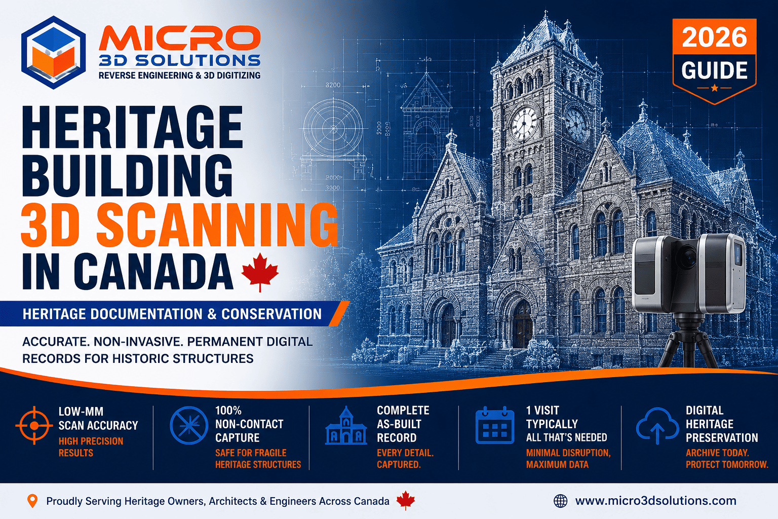
Heritage Building 3D Scanning in Canada
Heritage building scanning uses 3D laser scanners to capture the exact geometry of a historic structure — every wall, cornice, moulding, and structural detail — as a precise digital record, supporting restoration planning, condition monitoring, and long-term preservation without physical contact with fragile surfaces.
Get a Free Quote →What's Inside This Guide
By the engineering team at Micro 3D Solutions, GTA, Ontario — specialists in 3D laser scanning and as-built documentation for heritage and historic structures.
📋 Table of Contents
- What Is Heritage Building 3D Scanning?
- Why Heritage Buildings Need 3D Scanning
- How Heritage Building Scanning Works
- Applications of Heritage Building Scanning
- Scanning Technologies for Heritage Buildings
- Canadian & International Heritage Standards
- Digital Heritage Preservation
- Types of Heritage Properties We Scan
- Common Challenges We Solve
- Benefits of Heritage Building 3D Scanning
- 3D Scanning vs. Traditional Documentation
- Why Choose Micro 3D Solutions
- Frequently Asked Questions
What Is Heritage Building 3D Scanning?
Most heritage buildings in Canada were built long before CAD drawings existed, and many original drawings were never created or have since been lost, damaged, or scattered across archives. When restoration, structural assessment, or an addition is needed, there's often no accurate record to design from — architects end up working from partial photographs, old insurance surveys, or educated guesses. Canada has also historically had a patchwork approach to heritage protection compared to countries like the United Kingdom, with legislation that varies significantly by province and municipality, and no comprehensive federal heritage act covering privately owned buildings. That gap makes independent documentation, like a laser scan commissioned by the property owner, especially valuable: it exists regardless of what any single level of government requires. 3D scanning fills the documentation gap directly, capturing everything from overall massing to fine architectural detail in a single site visit.
What is heritage building 3D scanning?
Heritage building 3D scanning is the use of terrestrial laser scanners, and sometimes drone photogrammetry, to capture the complete geometry of a historic structure — from overall massing down to ornamental plaster and stonework detail. Millions of measurements combine into a point cloud, typically stored in an open format like E57 so it remains usable regardless of which software an architect or engineer works in years later.
The point cloud itself is only the starting material. Turning it into something an architect or contractor can actually use — measured plans, elevations, sections, or a full heritage building information model (often called HBIM) — is a separate point cloud to model conversion step, done by an engineer who interprets the raw geometry into intelligent, layered drawings.
Why Heritage Buildings Need 3D Scanning
Heritage structures carry a documentation problem few other buildings have. Original drawings, if they ever existed, are often incomplete, lost, or don't reflect a century or more of additions, repairs, and alterations. Many heritage buildings predate modern drafting standards entirely, or their original drawings were simply never archived anywhere accessible — leaving a scan as the first fully accurate record the building may ever have had. At the same time, these buildings are often the most fragile and the most restricted when it comes to physical measurement: hand-carved stone, historic plasterwork, and aged timber can all be damaged by repeated direct contact, which rules out some traditional survey methods entirely.
3D scanning addresses both problems at once. It captures a complete, accurate record without touching sensitive surfaces, and it does so in a single visit rather than requiring repeated site trips as a restoration project develops over months or years. That matters practically, too: contractors and conservation architects need precise dimensions to source matching materials, plan structural repairs, and design additions that respect the original building, and none of that is possible working from guesswork. There's also a permanence argument. Fire, structural failure, or slow deterioration can happen with little warning, and a scan taken today becomes an irreplaceable record if the building is ever damaged or lost — a documentation approach a growing number of heritage advocates now treat as a baseline precaution rather than an optional extra.
How Heritage Building Scanning Works
A heritage scanning project follows a careful, non-invasive process designed around the building's condition and any access restrictions, rather than a one-size-fits-all survey routine.
Site Assessment & Scan Planning
Our team reviews the building's condition, structural stability, and access constraints, along with any heritage designation requirements that might affect what documentation is expected. Scan station locations are planned in advance to work around occupied areas, restricted zones, or fragile elements that need extra care, and resolution settings are chosen based on how much ornamental detail the project needs to resolve.
Field Data Capture
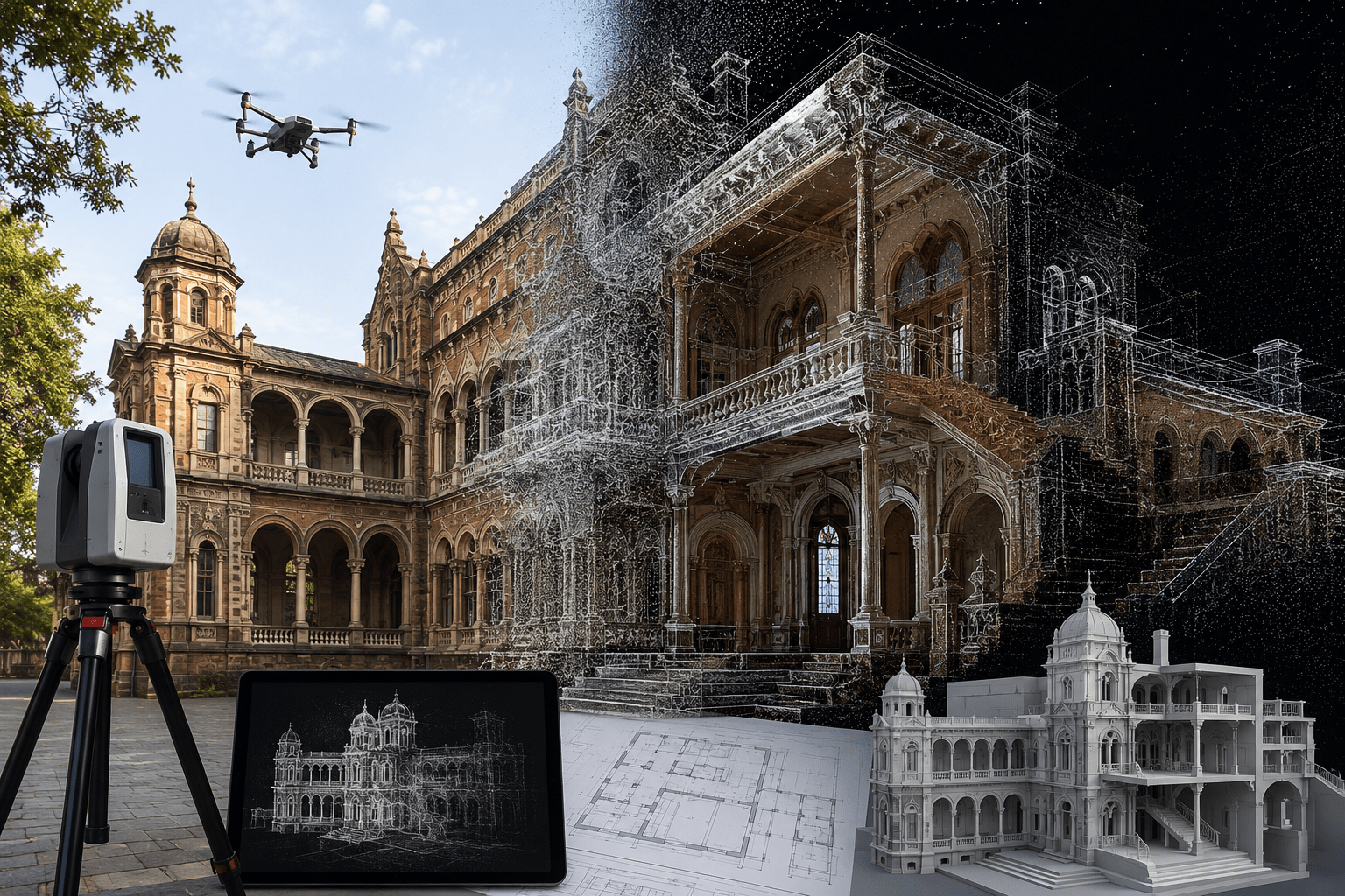
Terrestrial laser scanners capture interior and exterior geometry from multiple positions around and through the building, with overlapping coverage to eliminate blind spots behind columns, in alcoves, and around decorative features. Drone photogrammetry can supplement this for rooflines, towers, or facades difficult or unsafe to reach from the ground, and structured light scanning is sometimes added for small, highly detailed elements like carved capitals or sculptural mouldings.
Point Cloud Registration
Individual scans are aligned into one unified, accurately scaled point cloud of the entire structure, inside and out, using either survey control points or cloud-to-cloud registration software. Registration accuracy is checked against known reference measurements before the dataset is considered final, since any misalignment at this stage carries through into every drawing produced afterward.
Modelling & Documentation
Depending on the project, our engineers convert the point cloud into CAD as measured 2D drawings (plans, elevations, sections), a full heritage BIM model built in software like Revit, or both — matched to what the conservation architect or contractor actually needs for the work ahead. For projects supporting formal heritage designation or grant applications, documentation can be produced to align with the level of detail those processes typically expect.
Deliverables & Archive
You receive the registered point cloud and finished drawings or model, along with an archival copy suitable for long-term digital heritage preservation, independent of any single project's scope. Because the underlying point cloud and common exchange formats like E57 and IFC are software-neutral, that archive stays usable even if the tools an architect works in change over the coming decades.
Applications of Heritage Building Scanning
Heritage scanning supports a range of needs across the life of a historic property, from a one-time condition study to years of ongoing restoration work, and most projects end up serving more than one of these purposes from the same dataset.
For restoration and rehabilitation, accurate as-built drawings let architects design repairs and replacements that match existing profiles, mouldings, and proportions exactly, instead of approximating from photographs. For condition assessment and monitoring, comparing scans taken at different points in time reveals settling, bulging walls, or other structural movement that's difficult to detect by eye alone, giving engineers hard data instead of visual impressions. For digital archiving and preservation, a complete scan creates a lasting record of the building that has real value for insurance claims, historical research, and disaster recovery planning, should the worst ever happen.
When a heritage building is being repurposed through adaptive reuse, accurate geometry supports new mechanical, electrical, and structural design that respects the original fabric rather than working around unknowns. Municipalities and heritage committees also often request detailed documentation as part of a designation application or an alteration permit for a listed property, since decision-makers need an accurate record to evaluate what's actually being proposed. And beyond any single construction project, detailed 3D models increasingly support virtual tours, museum exhibits, and academic research into historic construction methods, giving a building's history a wider audience than the physical site alone ever could.
Scanning Technologies for Heritage Buildings
Most heritage projects don't rely on a single capture method. The right combination depends on the building's scale, the level of ornamental detail involved, and which areas are safely accessible.
| Technology | Best For | Typical Accuracy | Notes |
|---|---|---|---|
| Terrestrial Laser Scanning (TLS) | Interior & exterior detail, primary method for most projects | Low millimetre range | Precise enough for restoration-grade drawings and fine ornamental detail |
| Drone Photogrammetry | Rooflines, towers, upper facades difficult to access from ground | Lower than TLS | Sufficient for overall massing and elevation documentation |
| Structured Light Scanning | Small, highly detailed elements — carvings, capitals, mouldings | Sub-millimetre | Used selectively, not for whole-building capture |
| Mobile Mapping (SLAM) | Long interior corridors, large multi-room floor plans | Centimetre range | Trades some accuracy for faster interior coverage on large buildings |
Accuracy figures vary in practice depending on the specific equipment used, ambient site conditions, and surface material — reflective, dark, or transparent surfaces like stained glass can all reduce scan quality regardless of the technology chosen. Most heritage projects combine terrestrial scanning as the primary method with drone photogrammetry for upper facades and rooflines, adding structured light capture only for specific ornamental features that need extra detail.
Canadian & International Heritage Conservation Standards
Heritage documentation in Canada is generally guided by a consistent set of national, provincial, and international frameworks. Knowing which apply to a given property helps determine what level of documentation a project needs, and who ultimately signs off on whether that documentation satisfies conservation requirements.
The core national reference is the Standards and Guidelines for the Conservation of Historic Places in Canada, published by Parks Canada and used by municipalities and provinces across the country as a baseline for conservation decisions. For federally owned heritage buildings specifically, the Federal Heritage Buildings Review Office (FHBRO) evaluates proposed alterations against the building's heritage character, a process that typically depends on accurate existing-conditions documentation. Each province also carries its own heritage legislation governing designated properties — the Ontario Heritage Act is a common example — which can require documentation before alterations to a designated building are approved, and many municipalities maintain their own heritage registers with similar requirements layered on top.
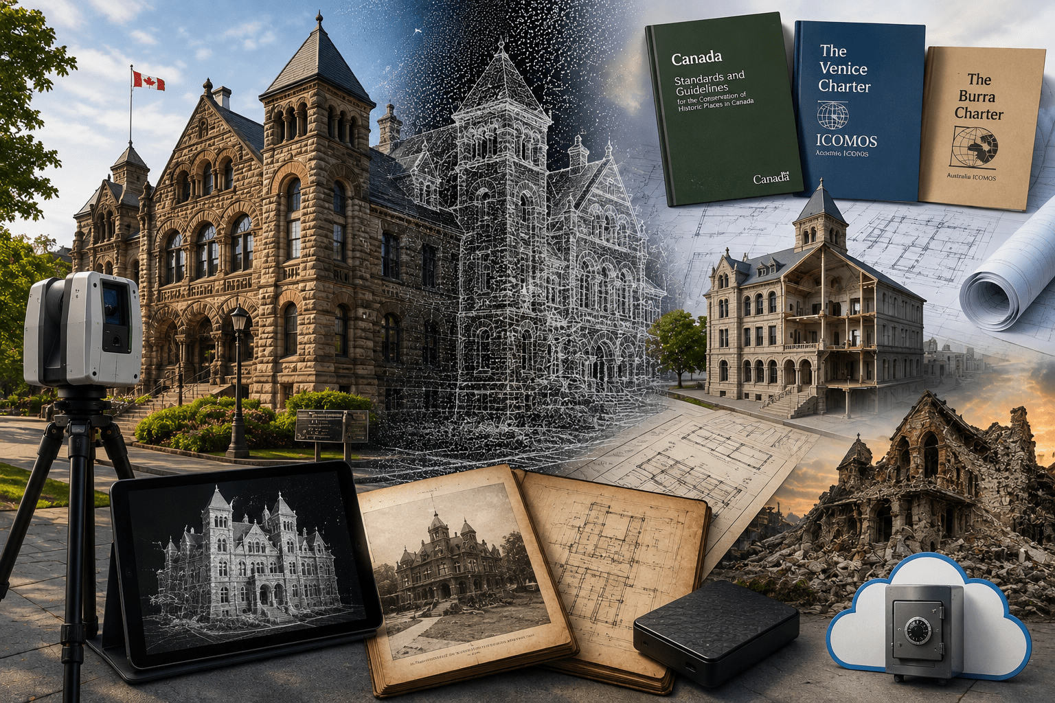
Beyond Canada's own frameworks, heritage documentation practice is also shaped by international conservation charters, most notably the ICOMOS Venice Charter and the Burra Charter, which established widely referenced principles around minimal intervention and evidence-based conservation decisions. These aren't Canadian regulations, but they inform how conservation architects and heritage planners think about what "accurate documentation" should actually capture. We don't make heritage designation or compliance determinations ourselves — that's the role of the property's heritage planner or conservation architect — but accurate scan data gives that professional a reliable, defensible record to base decisions on.
Digital Heritage Preservation: Beyond the Current Project
A heritage scan doesn't have to serve just the project that paid for it. Many owners and municipalities now treat the point cloud and model as a standing digital heritage preservation asset — an archival record that outlives any single restoration phase, stored in open, software-neutral formats like E57 for point cloud data and IFC for BIM models, designed for long-term digital archiving and future restoration work regardless of which specific software tools are current at the time.
That record has value well beyond the immediate use case. If the building is ever damaged by fire, flood, or structural failure, an existing scan becomes the reference for accurate reconstruction — a role point cloud archives have played in real heritage disaster recovery efforts internationally. It also supports future phases of work without repeating the capture process, and gives heritage committees and grant applications a documented baseline to reference when evaluating a property's condition over time. Some conservation architects now specify a particular heritage BIM "level of detail" up front, similar to how modern construction BIM projects define LOD requirements, so everyone involved agrees in advance how much ornamental and structural nuance the final model needs to capture.
Need Accurate 3D Scanning for a Heritage Building?
Whether it's a single facade, a full restoration project, or an archival record for a designated property, our team can capture and document your heritage building with the care fragile historic materials require.
Request a Free Consultation →Types of Heritage Properties We Scan
Heritage scanning applies across a wide range of building types, each with its own documentation priorities. Places of worship — churches, synagogues, and temples — often combine soaring interior volumes with intricate stonework, stained glass surrounds, and decorative woodwork, all of which benefit from detailed, non-contact capture that a ladder-and-tape-measure survey simply can't match. Civic and government buildings, including city halls, courthouses, and legislative buildings, frequently carry formal heritage designation and stricter documentation requirements before any alteration or restoration work can proceed, which makes a defensible, precise record especially important.
Museums and cultural institutions often need documentation both for their own building's preservation and to support interpretive displays or public programming about the structure itself, effectively turning the scan data into a public-facing asset as well as a technical one. Heritage homes and estate properties, from Victorian-era houses to larger manor buildings, benefit from accurate records ahead of restoration, additions, or resale, particularly when a buyer or insurer wants documented proof of condition. And former mills, factories, and institutional buildings undergoing adaptive reuse need geometry accurate enough to plan new mechanical and structural systems without compromising the character-defining elements that earned the building heritage recognition in the first place.
Common Challenges We Solve
Ornate & Highly Detailed Surfaces
Carved stone, decorative plaster, and intricate woodwork require dense, overlapping scan coverage to capture properly, so we plan scan positions specifically to resolve fine ornamental detail rather than just overall building shape.
Occupied & Publicly Accessible Buildings
Churches, museums, and civic buildings often need to stay in use during scanning, which means we schedule capture around events and public hours so the building doesn't need to close for the project.
Limited or Restricted Access Areas
Bell towers, roof spaces, and structurally fragile zones can be hazardous to reach directly, so drone capture and careful scan planning cover these areas with minimal physical entry.
Buildings With No Surviving Records
For buildings with no surviving records at all, the scan becomes the foundational document: every subsequent restoration decision traces back to that first accurate dataset, which raises the stakes for getting the initial capture right the first time.
Benefits of Heritage Building 3D Scanning
- A complete, accurate record for buildings with incomplete or missing drawings
- Non-invasive capture that protects fragile historic materials
- Supports restoration, adaptive reuse, and structural assessment from one dataset
- Creates a lasting archival record for insurance and disaster recovery
- Detects settling or movement when compared against future scans
- Reduces repeated site visits as a restoration project moves through phases
The value compounds over time. A building with an accurate digital record on file is better positioned for every future project, grant application, or emergency response than one without — and because the underlying point cloud stays valid until the building physically changes, that value doesn't expire when the current restoration project wraps up.
3D Scanning vs. Traditional Heritage Documentation
Traditional heritage documentation relies on hand measurement and photography: selective, time-consuming, and often requiring direct contact with fragile surfaces that a laser scanner avoids entirely by working from a standoff distance. It typically documents key dimensions and elevations that someone specifically thought to measure, while a 3D scan captures the full building geometry in one pass, including details that weren't on anyone's original checklist but turn out to matter later in the project.
The time difference is significant too. Detailed hand documentation of a complex heritage building can take weeks of site visits, while scanning typically completes field capture in days, reducing disruption to an occupied or public building. And there's a long-term difference in how each dataset ages: hand-drawn documentation is fixed to its original purpose and doesn't easily serve a different future need, whereas a point cloud can be revisited for entirely different projects — a different architect, a different scope, years later — without anyone returning to the building to re-measure it.
Why Choose Micro 3D Solutions
Heritage scanning calls for a different approach than a standard industrial survey. Our team brings careful, non-invasive scan planning suited to fragile and sensitive materials, along with experience delivering both measured drawings and full heritage BIM models depending on what a project needs. We coordinate directly with conservation architects and heritage planners on documentation requirements, combine terrestrial and drone capture for complete building coverage inside and out, and draw on the same as-built engineering, architecture 3D scanning, and reverse engineering expertise we apply to modern construction 3D scanning projects, based in the GTA and supporting heritage projects across Canada.
What to Prepare Before a Heritage Scanning Project
A short intake conversation helps scope the project accurately. It helps to have the following ready:
- Building type, approximate size, and heritage designation status, if any
- Any existing drawings or historical documentation, even partial or outdated
- Access requirements: occupied hours, restricted areas, permit or insurance needs
- Purpose of the scan: restoration design, condition study, archival record, or a combination
- Project timeline, particularly if scanning needs to align with a restoration phase or funding deadline
Frequently Asked Questions
What is heritage building 3D scanning used for?
It's used to create accurate as-built records of historic structures for restoration planning, condition monitoring, adaptive reuse design, heritage designation documentation, and long-term digital archiving.
Is 3D scanning safe for fragile heritage materials?
Yes. Laser scanning is non-contact — the scanner measures from a standoff distance, so carved stone, historic plaster, and aged timber aren't touched during capture.
How accurate is heritage building scanning?
Terrestrial laser scanning typically achieves low-millimetre accuracy, depending on equipment and site conditions — precise enough to capture fine architectural and ornamental detail for restoration-grade drawings.
What is heritage BIM (HBIM)?
Heritage BIM is a building information model built from scan data that represents a historic structure as intelligent, layered geometry rather than flat drawings. It lets architects query the model, generate custom views, and plan interventions directly against accurate as-built conditions.
Can scanning be done while a heritage building stays open to the public?
In most cases, yes. Scanning is scheduled around occupied hours and public events, and most buildings don't need to close during capture.
What deliverables do we receive from a heritage scanning project?
A registered point cloud, plus measured 2D drawings, a heritage BIM model, or both, depending on the project's needs — along with an archival copy suitable for long-term record-keeping.
Do you determine heritage designation or compliance requirements?
No. Designation status and compliance requirements are determined by the property's heritage planner, municipality, or conservation architect. Our role is providing the accurate documentation those decisions rely on.
Can scan data be reused for future restoration phases?
Yes. A registered point cloud remains valid until the building physically changes, so later phases of a multi-year restoration can reference the same dataset instead of commissioning a new scan.
How much does heritage building scanning cost?
Cost depends on building size, complexity, and level of detail required — a single facade scan costs far less than a full interior-and-exterior capture of a large structure. Most projects are quoted after a short scope conversation. Contact us for a project-specific estimate.
How long does a heritage scanning project take?
Field capture for a single building typically takes one to a few days, depending on size and detail level. Turning the point cloud into finished drawings or a full model takes longer, usually a few weeks, depending on the scope of deliverables requested.
The Bottom Line
Heritage buildings carry decades or centuries of history, but rarely the accurate documentation that history deserves. 3D scanning creates that record — a complete, non-invasive, measured account of the building exactly as it stands, ready to support restoration, monitoring, and long-term preservation regardless of what any single project ultimately needs it for.
Whether the goal is a single restoration project or a lasting archival record, an accurate scan is the foundation everything else builds from. Our team handles that capture and documentation end to end, delivered in the format your conservation architect or contractor needs, and archived in a form designed for long-term digital preservation and future restoration work. Talk to the Micro 3D Solutions team about your next heritage scanning project.
📚 Official References & Standards
- Parks Canada — Standards and Guidelines for the Conservation of Historic Places in Canada. historicplaces.ca
- Parks Canada — Federal Heritage Buildings Review Office (FHBRO). pc.gc.ca
- Province of Ontario — Ontario Heritage Act. ontario.ca
- Canadian Register of Historic Places — nationally searchable heritage property registry. historicplaces.ca
- ICOMOS — Venice Charter & Burra Charter, international conservation principles. icomos.org
- National Trust for Canada — heritage advocacy and conservation resources. nationaltrustcanada.ca