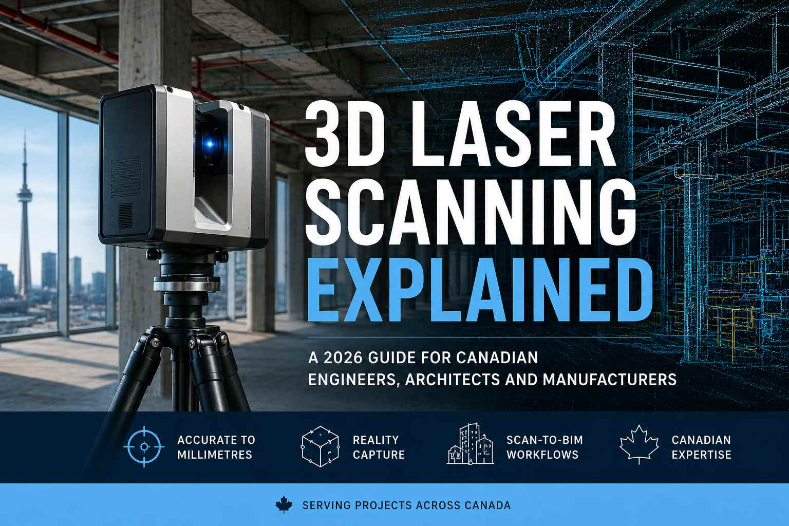
3D Laser Scanning Explained: A 2026 Guide for Canadian Engineers, Architects and Manufacturers
Published: June 06, 2026 · Updated: June 06, 2026 · Reading time: ~13 min
Walk into a downtown Toronto condo retrofit project in 2026 and you'll see something that wasn't there a decade ago: a tripod-mounted laser scanner quietly rotating in the centre of every floor, capturing millions of measurements per minute. Visit an automotive plant in Windsor, a heritage restoration in Ottawa, or a mining facility in Sudbury — and you'll find the same technology at work. 3D laser scanning has gone from a specialized survey tool to the default method for capturing reality in nearly every Canadian industry that builds, measures, or maintains physical assets.
This guide is written for engineers, architects, manufacturers, construction managers, surveyors, and facility managers across Canada who are evaluating 3D laser scanning for their projects in 2026. By the time you finish, you'll understand how the technology actually works, the different scanner types, accuracy levels, what it costs, and how to choose the right Canadian scanning partner.
3D laser scanning is a non-contact measurement technology that uses laser light to capture the exact geometry of physical objects, buildings, or environments. The scanner emits laser beams, measures how each pulse reflects back, and produces a dense 3D point cloud — a digital replica accurate to within millimetres. In Canada, 3D laser scanning is used across construction, manufacturing, heritage preservation, automotive, mining, and infrastructure sectors. Professional scanning services range from $1,500 for small commercial buildings to $25,000+ for large industrial complexes and Scan-to-BIM deliverables.
What this guide covers
- What is 3D laser scanning?
- How does 3D laser scanning work?
- Types of 3D laser scanners
- 3D laser scanning accuracy explained
- 3D laser scanning in the Canadian market
- Canadian industries using 3D laser scanning
- Scan-to-BIM and the AEC workflow
- How much does 3D laser scanning cost?
- The 3D laser scanning workflow
- How to choose a Canadian scanning provider
- The future of 3D laser scanning in Canada
- Frequently asked questions
What is 3D laser scanning?
3D laser scanning — also called reality capture or terrestrial laser scanning — is a non-destructive optical measurement method that captures the precise three-dimensional geometry of physical objects, buildings, and environments. The technology uses laser light to measure thousands of points per second, building up a dense cloud of measured 3D coordinates that together form an exact digital replica of whatever was scanned.
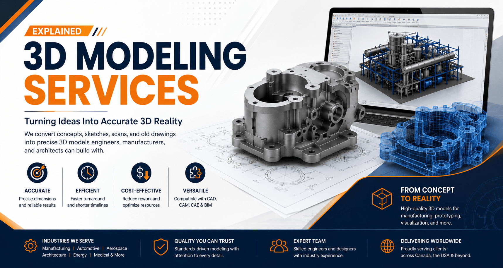
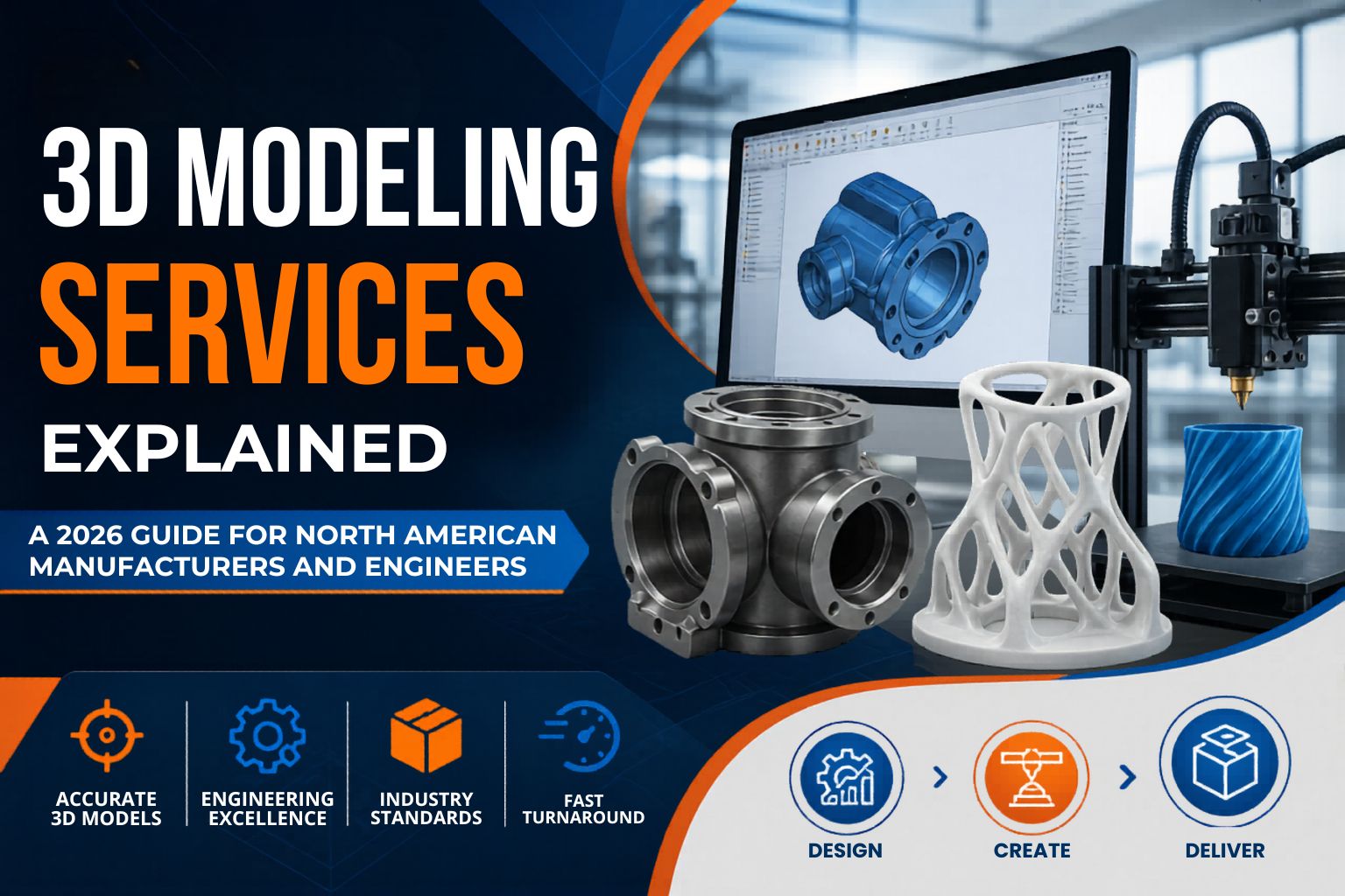
The fundamental output of any 3D laser scan is a point cloud: millions, sometimes billions, of individual points in 3D space — each one representing a specific location where the laser beam reflected off a surface. From this point cloud, engineers can generate 2D CAD drawings, parametric 3D CAD models, BIM (Building Information Modeling) files, mesh models for 3D printing, or analytical deliverables like deviation reports and volumetric calculations.
What makes 3D laser scanning powerful is what it eliminates. Traditional surveying captures one measurement at a time using total stations, tape measures, or theodolites. A modern terrestrial laser scanner captures the same data thousands of times faster — and with no need to physically touch the object. In a single 5-minute setup, a scanner can capture an entire room with every wall, every pipe, every ceiling fixture measured to within a few millimetres.
For deeper context on how scanning fits into the broader engineering workflow, see our companion guide on 3D modeling services and our recent article on LiDAR scanners — which covers a closely related technology.
How does 3D laser scanning work?
Every 3D laser scanner — regardless of brand or price — works on one of three fundamental principles: time-of-flight, phase-shift, or triangulation. Understanding which method a scanner uses helps you predict its range, accuracy, and suitability for your project.
Time-of-Flight (TOF) Scanning
Time-of-flight scanners fire a single laser pulse, then precisely measure the time it takes for that pulse to reflect off a surface and return. Since the speed of light is a known constant, distance is calculated by multiplying that travel time by the speed of light, then dividing by two. Time-of-flight scanners excel at longer ranges (up to several hundred metres) but typically deliver lower point density than phase-based scanners.
Phase-Shift Scanning
Phase-shift scanners emit a continuous laser beam modulated in waveforms. The scanner compares the phase of the emitted wave to the returning wave, calculating distance based on the phase difference. Phase-shift scanners are faster and more accurate than time-of-flight at short-to-medium ranges (typically under 350 metres), making them the dominant choice for indoor scanning, BIM, and as-built documentation in Canadian construction projects.
Triangulation Scanning
Triangulation scanners project a laser dot, line, or pattern onto a surface and use a separate camera to capture the reflection at a known angle. Using the geometric relationship between laser projector and camera, the scanner calculates the 3D position of each point. Triangulation is the most accurate method for short-range, small-object scanning — making it the standard for manufacturing metrology and quality inspection of precision parts.
The same word "3D laser scanning" can describe scanning a building from 100 metres away (time-of-flight) or scanning a 50 mm precision part to ± 0.02 mm accuracy (triangulation). Always confirm which scanner technology your provider plans to use — and match it to your project requirements before signing a quote.
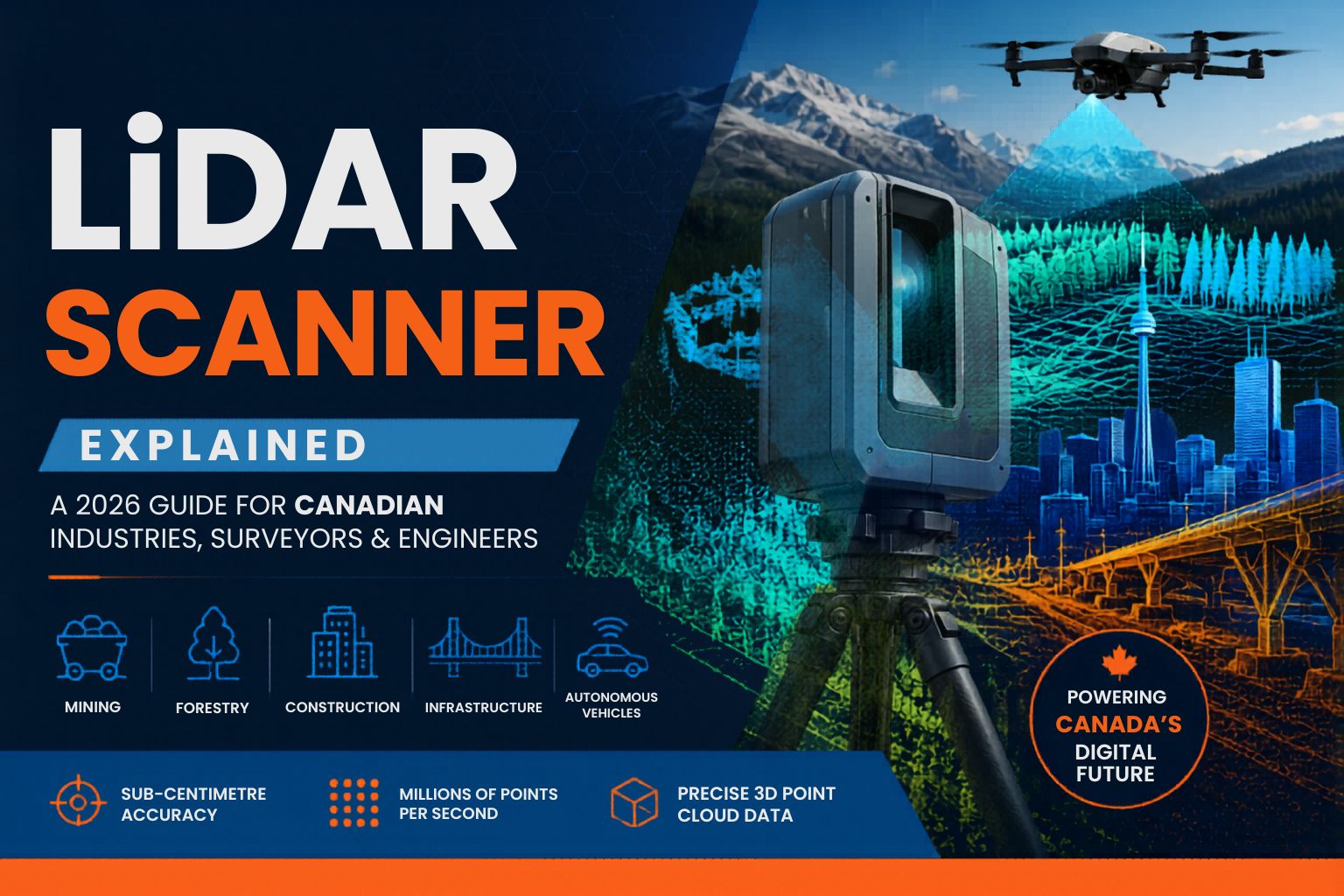
Types of 3D laser scanners
Beyond the underlying measurement principle, scanners are also categorized by deployment method. Most Canadian projects involve one of four scanner categories.
1. Terrestrial Laser Scanners (TLS)
Tripod-mounted scanners that capture a 360° field of view from a fixed position. The scanner is set up at multiple locations and individual scans are merged into a unified point cloud. TLS is the workhorse of construction, BIM, heritage, and industrial as-built documentation across Canada.
2. Handheld / Portable Scanners
Industrial-grade portable scanners for capturing individual parts, assemblies, or small areas. Used heavily in Canadian manufacturing, automotive, aerospace, and medical sectors. Companies like Creaform (a Canadian leader headquartered in Quebec) produce world-class portable scanners used by aerospace OEMs across North America.
3. Mobile / SLAM Scanners
Walk-through or vehicle-mounted scanners that use Simultaneous Localization and Mapping (SLAM) to track position while capturing data. Perfect for indoor environments, underground tunnels, large warehouses, and any area where setting up multiple tripod stations would be impractical or time-consuming.
4. Aerial / Drone-Based Scanners
Airborne laser scanners mounted on drones, helicopters, or fixed-wing aircraft. Used for large-area capture — topographic surveys, mining, forestry, infrastructure corridors, and any project where ground-based scanning would be impractical. Canada's vast terrain and resource sectors make aerial scanning especially valuable.
3D laser scanning accuracy explained
Accuracy is the single most important specification when selecting a 3D laser scanner for your project. The wrong accuracy class either delivers data that's useless for your application — or wastes budget on precision you don't actually need. Here's how Canadian professionals match accuracy to application:
| Application | Required Accuracy | Recommended Scanner |
|---|---|---|
| Metrology & quality inspection | ± 0.02–0.05 mm | Industrial handheld |
| Reverse engineering of parts | ± 0.05–0.1 mm | Industrial handheld |
| Heritage building documentation | ± 1–3 mm | Phase-based TLS |
| BIM modelling (LOD 300+) | ± 3–6 mm | Phase-based TLS |
| Industrial plant as-built | ± 2–6 mm | Phase-based TLS |
| Construction verification | ± 5–10 mm | Phase-based TLS |
| Indoor walk-through scanning | ± 1–5 cm | Mobile SLAM |
| Mining & topographic survey | ± 2–15 cm | Aerial / Drone |
Beyond raw accuracy, three other specifications matter: range (how far the scanner can reach reliably), point density (how many points per square metre — higher means more detail), and scan speed (points per second — affects how fast fieldwork is completed). A good Canadian provider will discuss all four parameters during the project quote.
3D laser scanning in the Canadian market
Canada is one of the world's most active 3D laser scanning markets — driven by a unique blend of resource extraction, infrastructure renewal, and advanced manufacturing.
Global 3D laser scanning market, 2026
Projected market by 2030
North America's share of global market
Projected CAGR through 2030
According to The Business Research Company, the global 3D laser scanning services market reached USD $8.84 billion in 2026 and is projected to grow to USD $12.85 billion by 2030 at a compound annual growth rate of 7.5%. Market Research Future puts North America's share at 45.4% of the global market — supported by high adoption in the United States and Canada across automotive, construction, healthcare, and aerospace.
Canada's market growth specifically is being driven by three structural factors. First, infrastructure modernization — major projects like the Ontario Line transit expansion in Toronto, heritage restorations across Ottawa and Montreal, and ongoing retrofits of government buildings demand precise as-built documentation. Second, resource sector applications — Canada's oil sands and mining industries use scanning extensively for asset management, plant optimization, and operational safety. Third, BIM adoption is now standard practice across Canadian AEC firms, and BIM workflows depend on accurate scan data to function.
Notable Canadian companies in the global 3D laser scanning ecosystem include Creaform (Lévis, Quebec) — a global leader in portable metrology scanners, BuildingPoint Canada, and Teledyne Optech (Vaughan, Ontario) — a major airborne laser scanning manufacturer. Kraken Robotics, based in Newfoundland, acquired 3D at Depth in 2025 to expand into subsea LiDAR imaging — reflecting how Canadian companies are shaping the future of the technology globally.
Canadian industries using 3D laser scanning
3D laser scanning is not a niche technology in Canada — it's embedded in routine workflows across the country's largest industries.
🏗️ Construction & AEC
As-built documentation, construction progress monitoring, clash detection, BOMA floor plans for commercial leasing. Standard across GTA high-rises, Ottawa institutional buildings, and Ontario Line transit projects.
🏛️ Heritage & Restoration
Non-invasive scanning of historic buildings, monuments, masonry arches, and architectural ornaments. Used extensively in Old Quebec, Toronto's Distillery District, and Parliament Hill restorations.
🚗 Automotive & Manufacturing
Reverse engineering of tooling, quality inspection of stamped panels, plant retrofit scanning. Critical in Southwestern Ontario's automotive hubs — Windsor, Oshawa, Hamilton.
✈️ Aerospace & Defense
Inspection of complex composites, fixture verification, reverse engineering of legacy components. Concentrated near Mississauga, Brampton, and Montreal aerospace clusters.
⛏️ Mining & Mineral Exploration
Underground drift scanning, pit surveying, stockpile volumetrics, processing plant documentation. Driven by Northern Ontario operations in Sudbury, Timmins, and Thunder Bay.
🛢️ Oil, Gas & Energy
Refinery and processing plant as-built scanning, piping documentation, and asset management. Important for Alberta oil sands operations and Atlantic offshore facilities.
🏥 Medical & Healthcare
Custom prosthetics, dental restorations, surgical planning models, and orthopaedic devices. Growing rapidly in Canadian healthcare research and clinical settings.
🎬 Film, VFX & Entertainment
Set scanning, prop documentation, location capture for digital matte paintings. Canada's strong film industry — particularly in Toronto, Vancouver, and Montreal — uses scanning routinely.
⚖️ Forensics & Public Safety
Crime scene documentation, accident reconstruction, fire investigation. Used by RCMP, OPP, and municipal police services across Canada for precise scene recording.
🎓 Education & Research
Archaeological documentation, geomatics research, museum digitization. Active at University of Toronto, McGill, University of Waterloo, and across Canada's research universities.
Scan-to-BIM and the AEC workflow
If you work in Canadian architecture, engineering, or construction, the single most important application of 3D laser scanning is Scan-to-BIM — the process of converting laser scan data into intelligent parametric BIM models, usually in Autodesk Revit.
Scan-to-BIM works like this: a terrestrial laser scanner captures the existing building or environment, producing a dense point cloud. Engineers then use that point cloud as a template to build an accurate Revit model — placing walls, floors, ceilings, doors, windows, MEP systems, and structural elements that exactly match the as-built reality. The result is a BIM model that accurately represents what was actually built, rather than what was originally designed.
This matters because legacy buildings rarely match their original drawings. Walls drift over decades. Renovations get added without documentation. Mechanical and electrical systems are modified informally over years of building operation. A Scan-to-BIM workflow captures the current reality, providing a reliable foundation for any renovation, retrofit, or extension project.
Common Scan-to-BIM deliverables include:
- Parametric Revit models at various Levels of Detail (LOD 200, LOD 300, LOD 350)
- 2D CAD drawings (DWG/PDF) — floor plans, elevations, sections, reflected ceiling plans
- IFC files for interoperability across BIM platforms
- BOMA floor plans for commercial real estate area calculations
- Deviation reports comparing as-designed vs as-built geometry
- MEP modelling for mechanical, electrical, and plumbing system documentation
Across the Greater Toronto Area, Scan-to-BIM is now standard practice for commercial high-rises, condo retrofits, and institutional renovations. In Ottawa, it dominates government facility documentation. In Southwestern Ontario, it serves manufacturing plant retrofits across Windsor, Hamilton, and London.
How much does 3D laser scanning cost in Canada?
3D laser scanning costs in Canada vary based on scope. Pricing is driven by site size, accuracy required, scanner type, travel distance, and deliverable complexity (raw point cloud vs full BIM model). Here are typical 2026 price ranges for professional services across Canada:
Buildings under 10,000 sq ft, single-floor commercial spaces, retail interiors. Point cloud delivery with basic deliverables.
Industrial facilities, multi-floor buildings, plant retrofits, full Scan-to-BIM with Revit deliverables.
Large complexes, multi-building campuses, mining-scale aerial surveys, heritage projects with detailed deliverables.
Metrology-grade industrial scanning
Industrial part scanning — for reverse engineering, inspection, or quality control — is priced separately and depends on part complexity. Typical pricing in Canada ranges from $500 per part for simple components to $10,000+ for complex assemblies requiring detailed deliverables, inspection reports, and CAD reconstruction.
On-site travel to remote locations, rush turnaround, full Scan-to-BIM deliverables vs raw point cloud only, sub-millimetre accuracy requirements, multiple revisits for active construction sites, and complex post-processing like deviation analysis or 4D progress modeling.
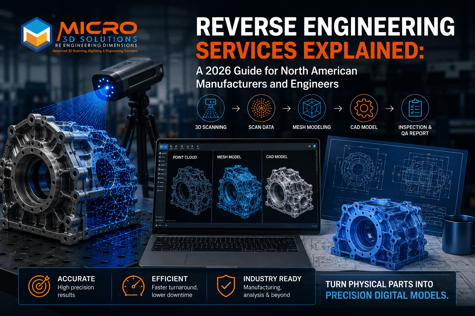
The 3D laser scanning workflow
Understanding the workflow helps you plan timeline and budget accurately. Most Canadian 3D laser scanning projects follow these five stages:
- Site assessment and planning — Provider reviews the project scope, identifies access constraints, selects the appropriate scanner type, and establishes control points if required.
- On-site data capture — The field crew deploys the scanner across multiple setup positions. A small commercial building takes 1–2 days; an industrial facility may take a week or longer.
- Registration and cleanup — Individual scans are aligned and merged into a unified point cloud. Noise, transient objects (people, vehicles), and irrelevant data are removed.
- Deliverable creation — The clean point cloud is converted into project deliverables: CAD drawings, BIM models, 3D meshes, or analytical reports — depending on project requirements.
- QA and delivery — Final deliverables are reviewed against project specifications and delivered in the requested format (LAS, LAZ, E57, RCP, DWG, RVT, IFC, STP).
Typical turnaround is 2–5 business days for point cloud delivery after on-site capture, and 1–3 weeks for full Scan-to-BIM models or complex deliverables. Rush turnaround is available from Canadian providers including Micro 3D Solutions for qualifying projects.
How to choose a Canadian 3D laser scanning provider
Not every Canadian scanning provider can handle every project. Mining survey work demands different equipment than aerospace metrology. Heritage scanning requires different sensitivity than industrial as-built. Here's how to evaluate providers before signing a contract:
- Scanner range and types. A provider with only one scanner type will push every project through that single technology — regardless of fit. Look for providers offering terrestrial, handheld, mobile SLAM, and aerial options.
- Industry-specific experience. Mining scans demand different rigour than commercial BIM. Heritage scanning requires expertise in working around fragile materials. Verify the provider has documented experience in your specific industry.
- Software and deliverable flexibility. Can they deliver in your preferred format? Native Revit (RVT), AutoCAD (DWG), standard point cloud formats (LAS, LAZ, E57), and direct integration with your engineering team's workflow.
- Post-processing capability. The scan is only step one. Look for providers who also handle 3D CAD modeling, 2D-to-3D conversion, and quality inspection — eliminating handoffs across multiple vendors.
- Geographic coverage. If your project spans multiple Canadian regions, work with a provider that operates province-wide or country-wide rather than coordinating multiple regional vendors with different standards.
- Compliance and certifications. Drone-based scanning requires Transport Canada SFOC certification. Mining sites may require Mining Common Core training. Highway scans require MTO traffic control approvals in Ontario. Confirm the required credentials before quoting.
- NDA and data security. Your scans often contain proprietary IP — building layouts, manufacturing facilities, sensitive infrastructure. Confirm the provider operates under NDA and has clear data handling policies.
The future of 3D laser scanning in Canada
Three trends are reshaping how Canadian businesses use 3D laser scanning through 2030.
AI-driven point cloud processing is dramatically reducing engineering time. Machine learning tools now automate noise removal, feature recognition, automatic classification (separating walls from windows from MEP), and even direct conversion of point clouds into parametric CAD models. Canadian providers adopting AI workflows are delivering Scan-to-BIM projects in days that previously took weeks.
Digital twins are becoming mainstream. Beyond one-time scans, Canadian facility owners are increasingly maintaining live digital twin models of buildings, plants, and infrastructure — updated regularly from periodic scans. The digital twin becomes a single source of truth for operations, maintenance, renovations, and emergency planning.
Cloud-based collaboration is eliminating geographic barriers. A scan captured in Sudbury can be processed in Toronto, reviewed by a client in Calgary, and integrated with a manufacturer in Quebec — all within a shared cloud environment. This is reshaping how Canadian engineering firms work on cross-regional projects.
Canada is home to global leaders in 3D laser scanning technology — Creaform (Quebec) for portable metrology, Teledyne Optech (Ontario) for airborne and terrestrial laser scanning, and Kraken Robotics (Newfoundland) for subsea LiDAR. This concentration of expertise gives Canadian businesses unique access to world-class scanning capabilities without going offshore.
Frequently asked questions
3D laser scanning is a technology that uses laser light to measure thousands of points per second on a physical object or building — creating a precise digital 3D copy. It's like a high-tech camera that captures exact geometry instead of just colour and light. The result is a point cloud that can be converted into CAD drawings, BIM models, or 3D meshes.
Accuracy depends on the scanner. Metrology-grade industrial scanners achieve ± 0.02 mm for small parts. Phase-based terrestrial scanners deliver ± 1–3 mm for BIM and as-built work. Time-of-flight scanners achieve ± 2–6 mm at longer ranges. Handheld scanners typically deliver ± 0.05–0.1 mm. The right accuracy depends entirely on what you're measuring and why.
The terms are often used interchangeably. LiDAR (Light Detection and Ranging) is a specific subset of 3D laser scanning that uses time-of-flight measurement with pulsed laser light. 3D laser scanning is the broader category and includes LiDAR, phase-shift scanners, triangulation scanners, and structured-light systems. Most modern terrestrial scanners used for surveying, BIM, and construction are technically LiDAR-based — but the industry uses both terms.
On-site scanning typically takes 1–2 days for a standard commercial building, a few hours for a single industrial part, and multiple days for large facilities. Data processing and deliverable creation usually takes 2–5 business days for raw point clouds and 1–3 weeks for full Scan-to-BIM models or complex deliverables. Rush turnaround is available from Canadian providers for qualifying projects.
Yes — this is one of the most common applications in Canada. Terrestrial laser scanners are designed to capture interior building details: walls, floors, ceilings, MEP systems, doors, windows, and structural elements. A single setup captures a full 360° view, and multiple setups are merged to build complete interior coverage. The resulting model is used for renovations, retrofits, heritage documentation, and facility management.
Yes. Commercial 3D laser scanners use Class 1 or Class 1M lasers, which are eye-safe under normal operating conditions. The scanning process is completely non-contact and non-destructive — meaning no physical interaction with the object being scanned. This makes 3D laser scanning ideal for heritage buildings, fragile artifacts, and active industrial environments where workers continue operating during the scan.
The most common output formats are LAS and LAZ (compressed LAS) for raw point clouds — industry standards. E57 is a vendor-neutral format widely supported across software platforms. RCP is Autodesk's recall format used in Revit and AutoCAD workflows. Processed deliverables are typically provided as DWG (AutoCAD), RVT (Revit), IFC (BIM exchange), STP (CAD), or PDF for 2D drawings.
In many applications, yes — and it already has across most of Canadian AEC. Where traditional surveying captures individual measurement points one at a time, 3D laser scanning captures millions of points in minutes. For as-built documentation, BIM workflows, building renovations, and complex interior environments, laser scanning is now the default method. Traditional surveying still has roles in boundary work, legal cadastral surveys, and pure topographic mapping where laser scanning may be overkill.
Need Professional 3D Laser Scanning in Canada?
Micro 3D Solutions delivers full-service 3D laser scanning, Scan-to-BIM, and Scan-to-CAD from our Richmond Hill, Ontario facility — serving construction, AEC, manufacturing, heritage, mining, and aerospace clients across Canada.
Contact Our Scanning Team →Explore more from our knowledge base: 3D Modeling Services Guide, LiDAR Scanner Guide, 3D CAD Modeling, Reverse Engineering Services, Quality Inspection, and 2D to 3D Conversion. Learn more about our team, visit the Micro 3D Solutions homepage, or contact us for your project quote.